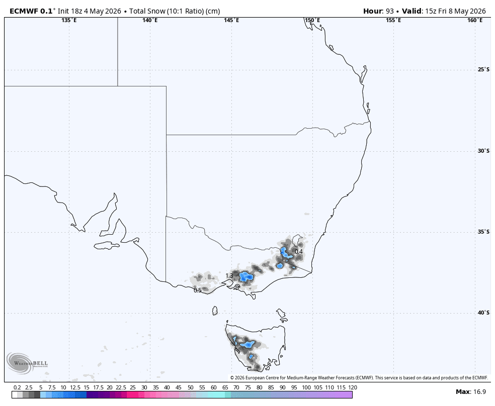
According to a report from WeatherBrains via SnowBrains, a short-duration cold front is moving toward the Australian mountains. This system is expected to provide a necessary boost to base levels, though it comes at a time when all resorts remain closed for the season.
The weather activity is slated to begin in Tasmania on Wednesday afternoon, moving into New South Wales and Victoria late Wednesday night through Thursday. While model data shows high confidence in the timing of the front, there remains some variance regarding local intensity across different regions.
Regional Snowfall Expectations
Forecasters anticipate the following accumulation totals through Friday, May 8:
- Mount Baw Baw: 19-26 cm
- Charlotte Pass: 14-20 cm
- Thredbo: 12-17 cm
- Mount Buller: 11-16 cm
- Falls Creek: 10-15 cm
- Perisher: 10-14 cm
- Mount Hotham: 10-14 cm
- Selwyn Snowfields: 8-11 cm
- Mount Mawson: 6-8 cm
- Ben Lomond: 0 cm


Weather Conditions and Impacts
The system will bring fluctuating snow levels, starting between 1,500 and 1,900 meters before dropping to 700-1,100 meters on Thursday. Initial snow may be heavy or wet, with Snow-to-Liquid Ratios (SLRs) improving as temperatures drop toward -5°C. High winds are expected to be a significant factor, with gusts potentially exceeding 100 km/h on exposed ridges near Mount Mawson.
By Friday, the storm will taper off, leaving behind a quieter, drier pattern heading into the following week. Temperatures are expected to rise above freezing, and current modeling does not indicate any immediate follow-up storms within the first ten days of May.