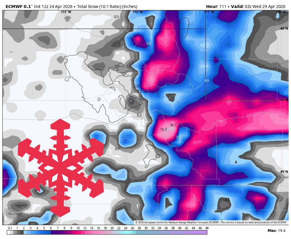
According to a report from SnowBrains, Utah is set to experience a late-season boost in snowpack as an active spring pattern moves into the region. Meteorologists anticipate that the most significant accumulation will occur between late Saturday night and Tuesday, April 28.
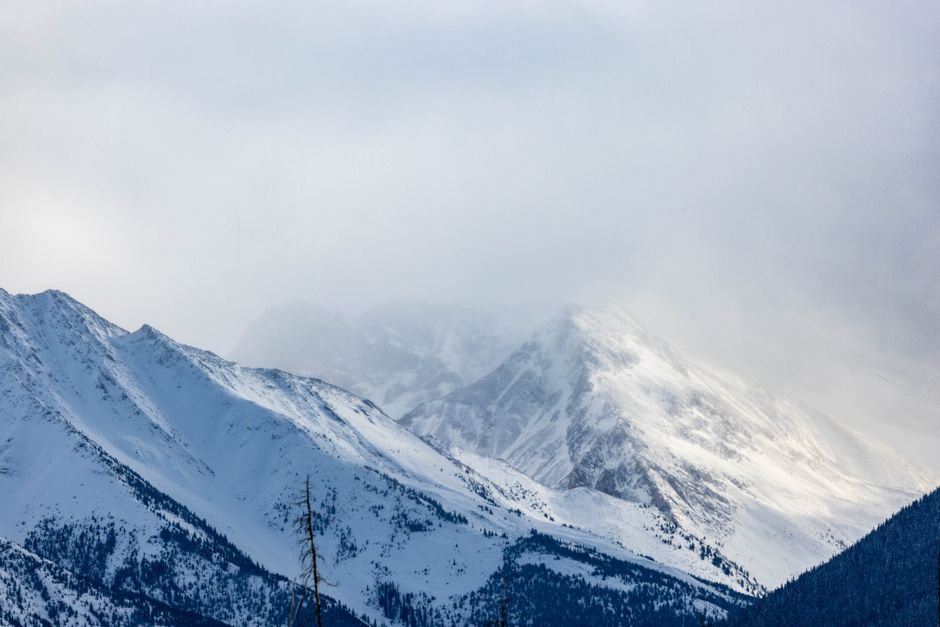
While the storm system is expected to impact much of northern and central Utah, the models are most consistent regarding heavy accumulation in the Cottonwood Canyons. Resorts such as Alta, Snowbird, and Brighton are expected to be the primary beneficiaries of this weather event. However, enthusiasts should note that because many resorts have already ceased operations for the season, these totals serve more as a forecast of mountain conditions rather than a guide for accessible lift-served skiing.
Storm Dynamics and Snow Quality
The system is expected to be relatively quiet on Friday and Saturday before precipitation ramps up significantly on Saturday night. Forecasters note that while there is strong consensus on the timing of the event, there is still some divergence regarding the final intensity of the storm. The heaviest snow is expected to fall through Sunday and Monday, with the system beginning to taper off into scattered showers by Tuesday.
Snow levels are projected to fluctuate between 6,000 and 8,500 feet. This means that while higher elevations will enjoy consistent, wintry conditions, lower terrain may experience wetter, heavier snow during warmer intervals. The Snow-to-Liquid Ratio (SLR) is expected to hover between 10-14, which is typical for spring-like conditions. Additionally, hikers and backcountry travelers should be prepared for wind gusts ranging from 20 to 40 mph on exposed ridges during the peak of the storm.

Looking Beyond Tuesday
The long-term outlook remains less certain. After the storm clears on Tuesday, models suggest a return to a warmer-than-average pattern. While there are weak signals for potential high-elevation snow around Thursday and again on May 4, the current data points toward minimal accumulation for those later dates. As with any late-season weather event, conditions can shift rapidly, and those planning to head into the mountains should monitor updated forecasts closely.

Resort Forecast Totals (April 25–28)
- Alta: 14-21 inches
- Snowbird: 14-21 inches
- Brighton: 12-18 inches
- Solitude: 10-15 inches
- Park City: 8-12 inches
- Eagle Point: 7-11 inches
- Powder Mountain: 7-11 inches
- Deer Valley: 6-9 inches
- Beaver Mountain: 4-6 inches